|
 |
| 14-08-2008 THE WALK OVER THE CORRIEYAIRACK PASS
|
The Corrieyairack Pass is an Old Military Road, built by the government troops under the command of General George Wade. The road was built over a summer in the year 1737 prior to the 1745 Uprising and stretches from Dalwhinnie to Fort Augustus. The Corrieyairack was one of a series of roads which linked various government barracks together, hence adopting the name ‘The Chain’. The old road from Dalwhinnie to the Melgarve Bothy can still be traced as it follows the A889 to Laggan, but is tarmac now instead of the old surface of stones. Where the road is broken there are the occasional Wade’s Bridges which reminds us of the line which the road actually took joining the new road from Laggan. The road then follows the River Spey to the bothy, it is at the Melgarve Bothy that our walk begins. After turning off the A86 at Laggan, we followed the 6 mile single track road to Melgarve Bothy, the road is quite narrow in places and although only 6 miles it seems to go on for a lot longer, no complaint though as the weather and the scenery was fantastic, the further we drove the more into the wilderness we got, a landscape which hasn’t really changed in centuries. On route there is a place of interest, ‘Garvamore’ in 1745 an Inn stood here, where some of the deserters from Cope’s army waited for the Prince and where the Prince held council and stayed the night after crossing the Corrieyairack. At the end of the tarmac road we reached the bothy, beyond this is point there are no public vehicles allowed, we were the only ones there so got the first choice of what the simple and basic accommodation had to offer. Although bothies are quite basic they are usually found in remote areas surrounded by fantastic scenery and Melgarve is no exception. Within 10 minutes of unloading the gear we were joined by a party of 6 guys from the Middlesborough area and lucky enough there was plenty of room in the inn and after settling in we gathered communally outside for a cold beer. There was a heat in the sun and the scenery was breath taking, with only the sound of our own voices being heard as we took the time to educate our foreign friends to the history of the Corrieyairack Pass. As the sun disappeared we retreated into the bothy to enjoy some music and a dram in front of the warm and hypnotic flames of the fire. |
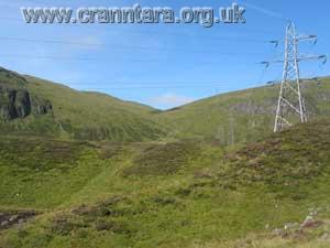
| Day of the walk, we rose early and had breakfast, then washed in the fresh water of the burn running nearby. As there was still a couple of hours before setting off I took the opportunity to get a few pics. I was told the last time I walked the old road where the remains of General Wades headquarters stood in 1737 while the work on the Corrieyairack was being carried out and also of an old General Caulfield bridge that was built in 1750, which was hidden away in a clearing in the trees, these were about a quarter of a mile back, so having a bit of time I went to find them. 10am, set off from the Melgarve Bothy heading west towards the Corrieyairack Forrest rising slowly on the straight and mild incline with the heat of the sun on our backs. The road passed between the hills of Carn Leac on the left and Gairnbeinn on the right with both their majestic peaks nearly three thousand feet high. Military roads tend to be long and straight where possible, and looking back to the Melgarve bothy is a prime example, whether this was adopted from the Romans I don’t know, but in any case it was to make it as easy as possible for the manoeuvring of large volumes of soldiers and equipment. Veering right and out of view of the bothy still climbing mildly, the only thing that reminds us of 21st century life is the unsightly pylons which blot the landscape. Due to the dryness of the weather there were a few little burns and fords to cross which other wise might have been in full spate, in sight was the twisting road about a mile in front which winds its way up to the plateau at the summit of the Corrieyairack, seventeen steep zig-zags in all, this was made in such a way that it was easier to get to the top particularly with heavy artillery. Reaching the top of the plateau there are magnificent views east towards Laggan. It is a this point on the plateau in 1745 where Lord George Murray states that when he and Lochgarry arrived here at the highest point of the pass they expected to see General Cope and his red-coated army slowly wending its way across the plain beneath, much to their surprise though there was not a creature to be seen. Fearing an ambush they proceeded cautiously until they got half way down the southern slope they noticed a party of armed men some distance off, which they took for Cope’s advance guard of Highland soldiers; upon more careful observation Lochgarry came to the conclusion that whoever they might be they were not enemies. As they came closer they made signs of friendship and satisfied that they were no enemy the two officers rode down the hill to learn what they wanted. It transpired that the strangers were a body of forty soldiers who had deserted from Cope’s army the day before and on their way to offer their services to Prince Charles. The spokesman, a MacPherson told Lochgarry that Cope had held a council of war the day before [August 27th ] at Dalwhinnie, when it was determined to abandon the idea of attempting the passage of the Corrieyairack as it was considered too dangerous. The army had already began to march on the road to the pass, but were ordered to wheel about and most likely headed to the Barracks at Ruthven instead. [ Murray and Lochgarry were sent forward to reconnoitre in front of the 1800 or so Jacobite Army which were behind them] |
Taking in the magnificent views on top of the plateau we decided to stop for some refreshment, sitting at the roadside surrounded by the glorious purple heather, with the view of the peaks surrounding Glen Affric away in the distance. There is another blot on the landscape, the towering wind turbines on the other side of the Great Glen on the hills above Invergarry. By Jim Singer |
 |
 |
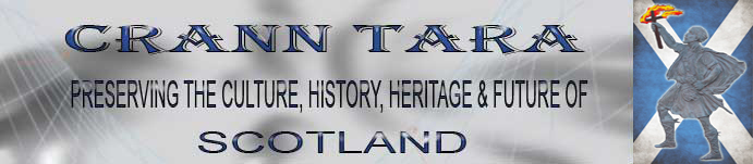
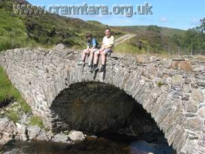
Old Wade bridge with Melgarve Bothy behind. |
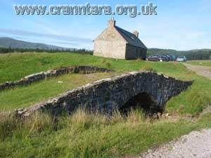
Round the fire in the bothy. |
 |
 |
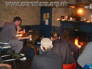
The Room we slept in. |
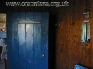
Room within the bothy depicting Wade's office. |
 |
 |
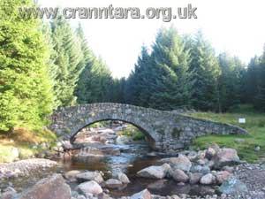
Melgarve East Bridge built by Caulfield |
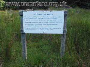
Plaque at Megarve East Bridge. |
 |
 |
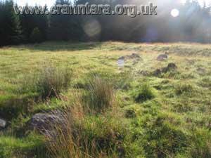
Remains of General Wade's headquarters used during the building of the road. |
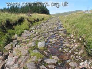
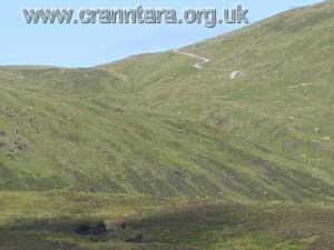
A close view of the military road |
 |
 |
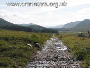
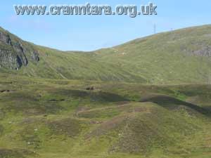
Looking back at Melgarve Bothy |
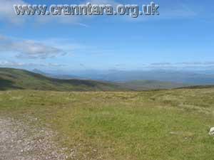
Easterly view looking back towards Laggan |
 |
 |
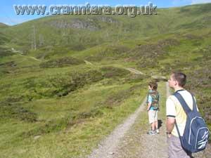
James and Connor looking at the road ahead |
The road ahead |
 |
 |
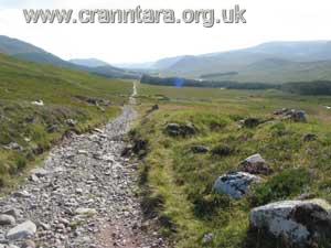
The road twisting to the Plateau, through the Corrieyairack Pass |
Unsightly blot on the landscape |
 |
 |
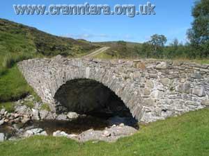
Another Wade bridge approx halfway |
James and Connor take a well earned break. |
 |
Westerly view towards Fort Augustus from the plateau |
|